Wednesday, September 06, 2006
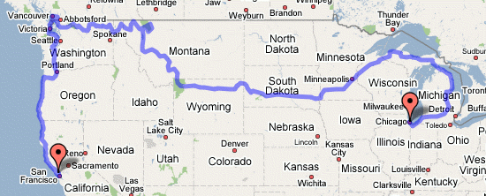
Our Route So Far
Here is a link to a VERY ROUGH map of our route so far. Don't zoom in too much because it doesn't really follow the roads specifically, that would take too much time. The mileage is off too because of the vague route. This will give you a general visual representation of where we have gone. Our mileage is currently approach. 3250 miles.
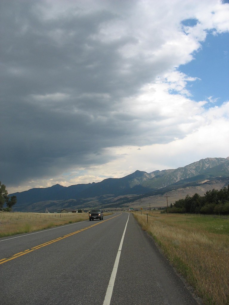
Back in the high country.
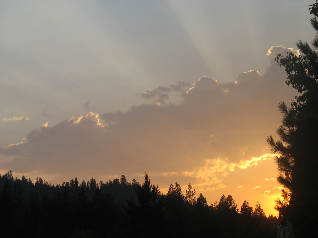
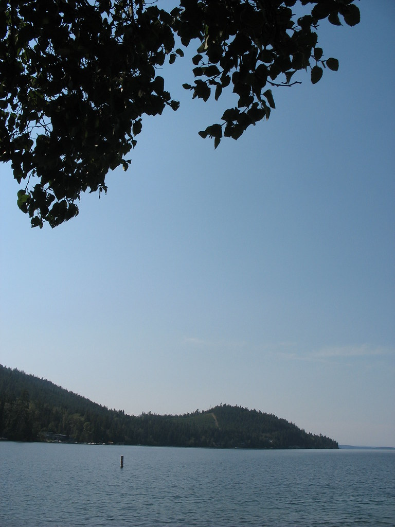
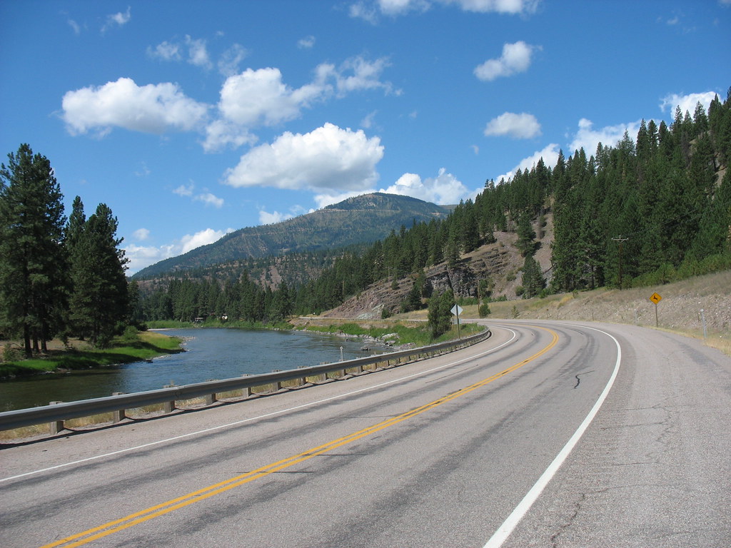
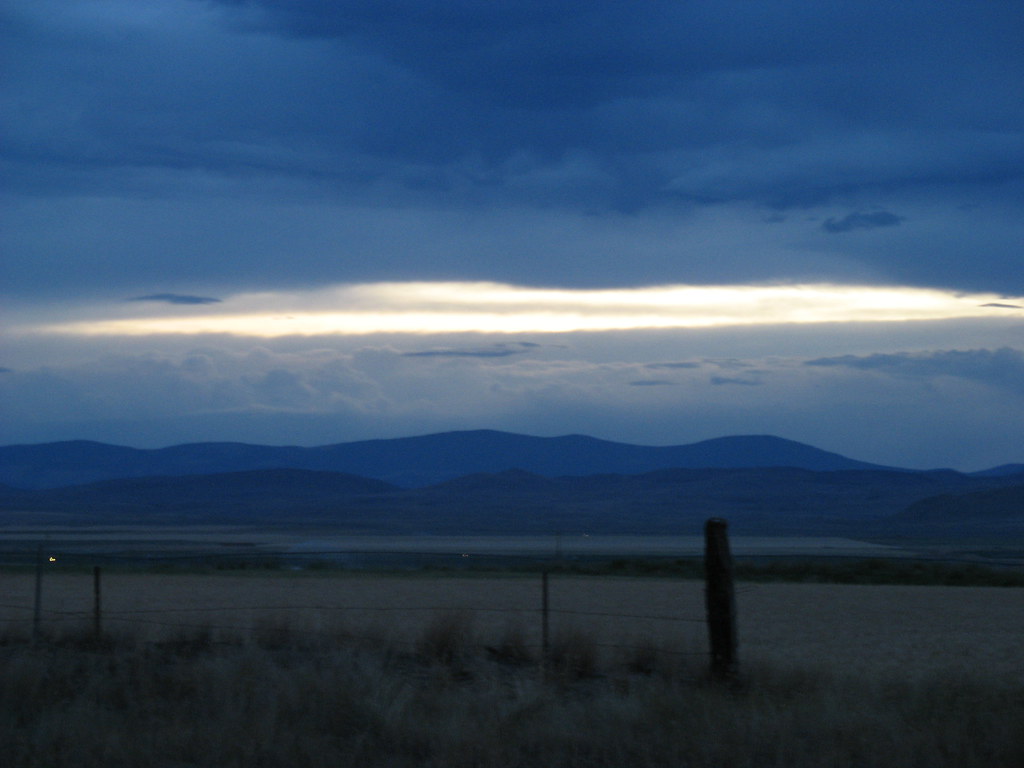
We started climbing to Sherman Pass last night, riding untill sunset. At 5575 ft, forty-three hundred feet above the Columbia River, it was our second highest climb of the trip.
We camped in the Colville National Forest and got up at five thirty to reach the pass by nine thirty. Clif Bars are on sale everywhere around here so I snacked on the way up.
There are things called Chinook Winds that blow hot air down from the coast during the winter and trick the trees into thinking it's time for sap to run. Then the winter cold comes back and the trees freeze so fast they explode. That's what my legs felt like toward the top of the pass. We made it though, and coasted down to Republic.
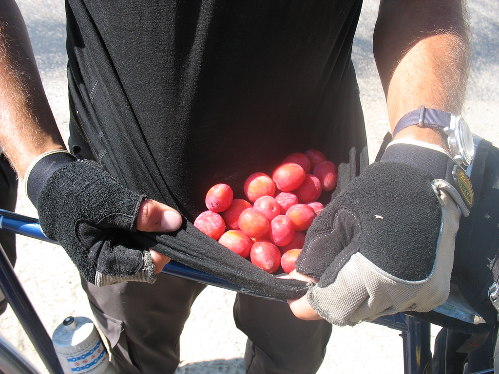
Wild fruit is in season everywhere. I've been picking plumbs and apples on the roadside. Don't eat too much or you will get sick!
Here's our route through Washington so far.
Tuesday, September 05, 2006
Don't Blink Or You Might Miss It
Hey we're in Idaho
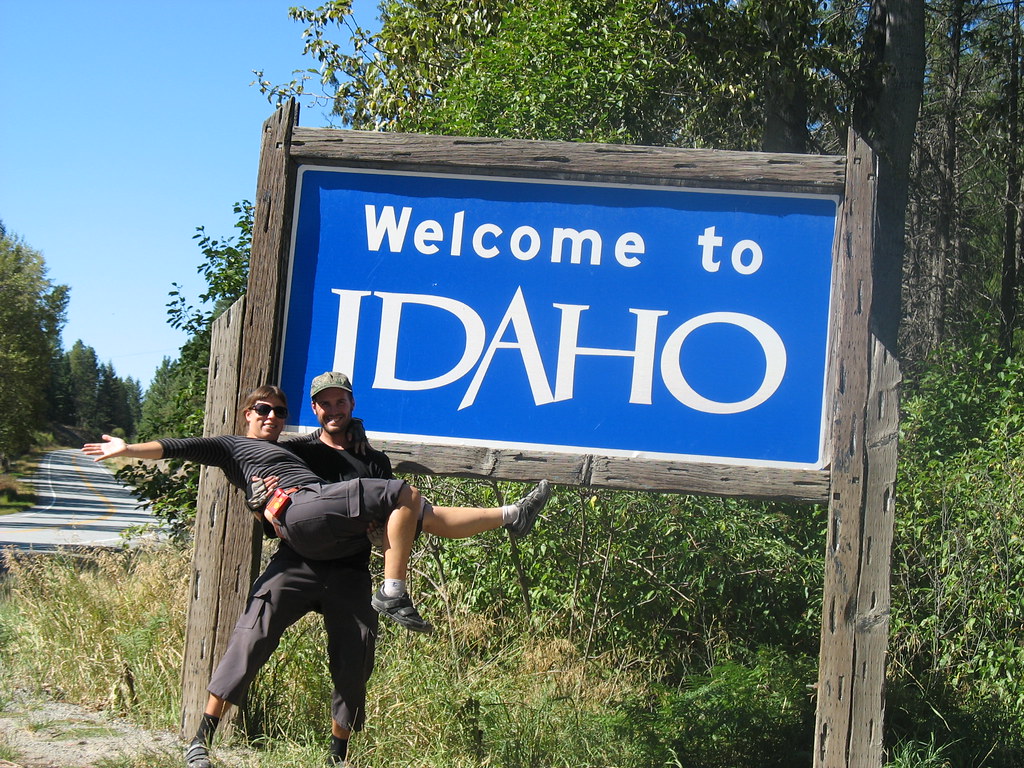
Hey we're in Washington.
There wasn't a sign in Washington to take our pic by. So no triumphant pose. OH well.
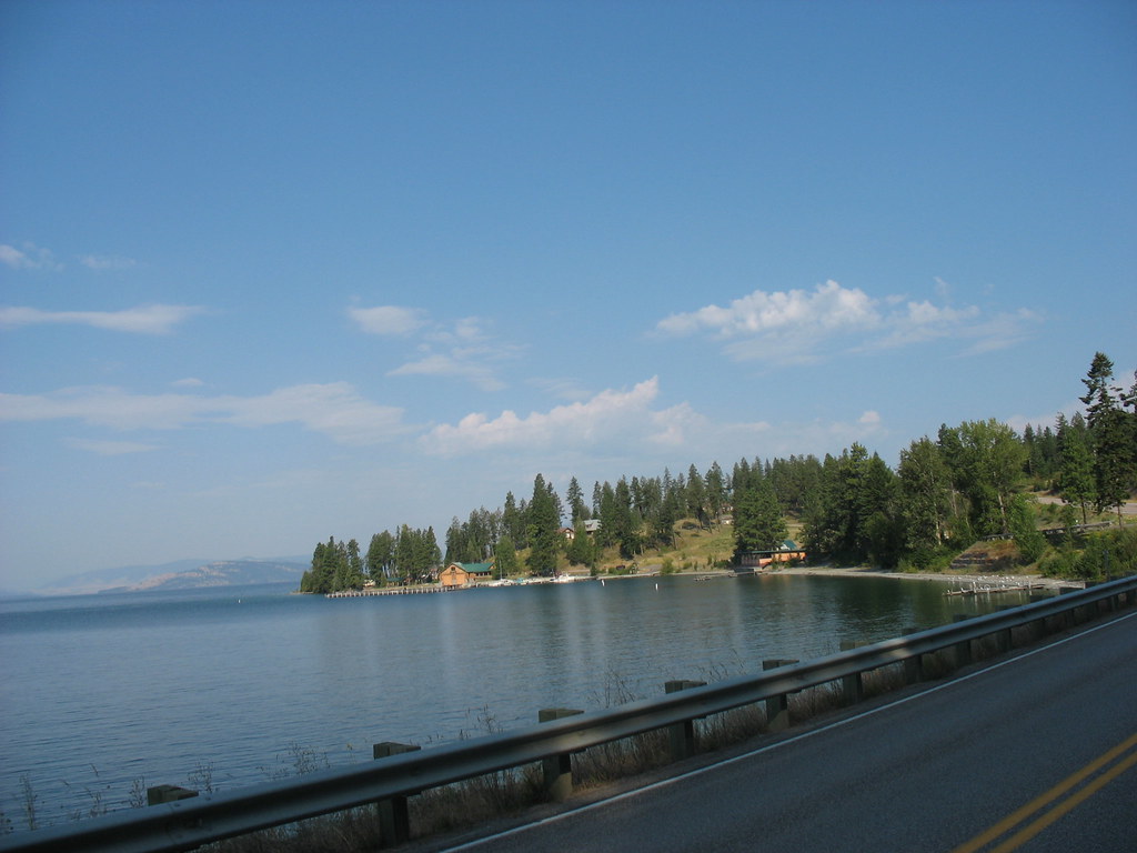
We spent all of a day and two nights it Idaho. We followed the Pend Orielle River (pronounced Ponderay) into Washington and it was incredibly scenic. They get more rain in this area so the woods were green with ferns and more lush pine trees. We camped in a couple's yard in Priest River. That night, we had a bear sniffing around our tent. Ira will tell about in his post so I won't go into detail. I didn't actually experience it because I had my ear plugs in (which I use to protect myself against Ira's snorring) and was oblivious. I can see why a bear would want to hang out here though.

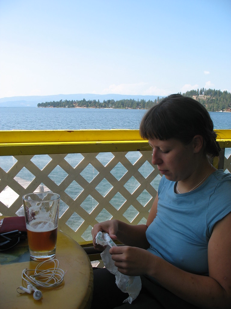
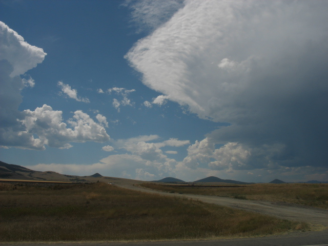
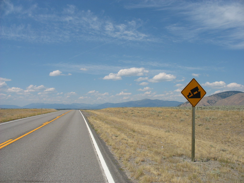
We followed the Pend Orielle for about 60 miles and veered off yesturday. We climbed a 1000 ft ridge which brought us back into a more arid climate. We are taking the day off in Kettle Falls today to swim and relax in the Columbia River and tomorrow we will climb Sherman's Pass, so hopefully we will enter a greener climate again.
We have four more mountain passes to climb here in Washington. Although they are not as high in altitude as previous ones, they are steep. Shermans will be 4000 ft in 25 miles.
The temperature has been really warm the past couple of days. Its been in the mid 90s every day. In northern Washington in September??? Duh Duh Duh. Must be the evil Global Warming again. Hopefully it will cool down soon.
Hey we're in Washington.
There wasn't a sign in Washington to take our pic by. So no triumphant pose. OH well.
We spent all of a day and two nights it Idaho. We followed the Pend Orielle River (pronounced Ponderay) into Washington and it was incredibly scenic. They get more rain in this area so the woods were green with ferns and more lush pine trees. We camped in a couple's yard in Priest River. That night, we had a bear sniffing around our tent. Ira will tell about in his post so I won't go into detail. I didn't actually experience it because I had my ear plugs in (which I use to protect myself against Ira's snorring) and was oblivious. I can see why a bear would want to hang out here though.
We followed the Pend Orielle for about 60 miles and veered off yesturday. We climbed a 1000 ft ridge which brought us back into a more arid climate. We are taking the day off in Kettle Falls today to swim and relax in the Columbia River and tomorrow we will climb Sherman's Pass, so hopefully we will enter a greener climate again.
We have four more mountain passes to climb here in Washington. Although they are not as high in altitude as previous ones, they are steep. Shermans will be 4000 ft in 25 miles.
The temperature has been really warm the past couple of days. Its been in the mid 90s every day. In northern Washington in September??? Duh Duh Duh. Must be the evil Global Warming again. Hopefully it will cool down soon.
Elk in the produce section!
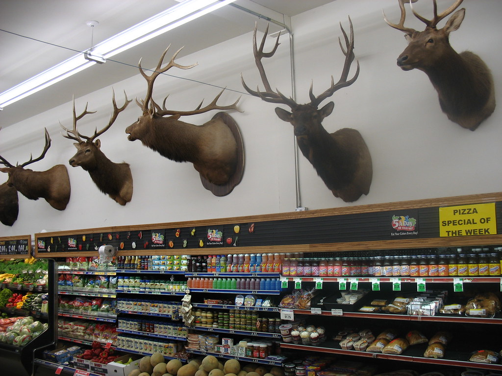
Troy, Montana. There were also moose and a few white tail deer. Bizzare.
It's a busy day at the library so this is a short post. We've passed through the Idaho Panhandle and into Northeastern Washington in the last week and are taking a break in Kettle Falls, where they have a great organic grocery store.
About that bear in Priest River. It was two thirty on the morning and I couldn't fall asleep. There was a crashing in the brush outside, but the rainfly on the tent blocked me from seeing anything. A set of heavy footfalls started coming toward us and I was instantly terrified. Each muted thump sounded like it had hundreds of pounds behind it. I imagined many awful outcomes. The footsteps stopped. The very sharp profile of a black bear face appeared in the moonlight, two feet above my head. Even more awful outcomes flashed through my head. It felt like this went on forever, but it was probably less that thirty seconds. The face and footfalls went away, but I was paralyzed for a while longer. I woke Andrea but she was sleeping with earplugs and missed the whole thing. My dreams were haunted with bears for the rest of the night.
Ok, gotta go. Over and out.
Thursday, August 31, 2006
A Stitch in Time Saves 15 Miles
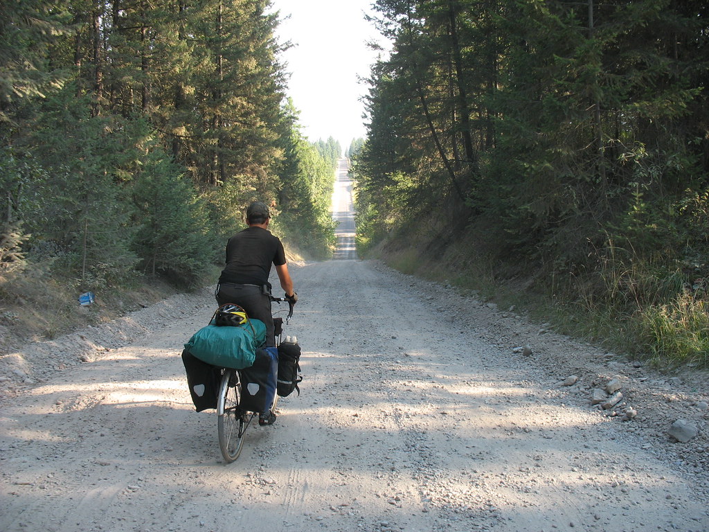
Going from Trego to Libby Montana, we were unsure of which road to take. On the state map, a dirt road was shown which would cut off many miles of the northern or southern routes available. However, we were unable to figure out what road this unlabeled dirt road was. A construction worker told us to take the road we were on and two lefts which would lead us to Libby, assuring us this was the best way. However, when we got to the fork, it said, highway 37 (the road to Libby)was 41 miles away. So this was the long route. I stopped the mailman in his brown truck who we had been playing catch up and pass all day as he kept pulling over to deliver his mail. He told us the right fork in the road would lead to highway 37 but that it wasn't an easy road. The road was fraught with a steep downhill grade and lots of sharp rocks to puncture our tires as well as bears. "If you have trouble out there, you'll go for miles without seeing anyone else." he cautioned. But he agreed it was the quickest way and was kind enough to give me his forest service map to guide along the way.
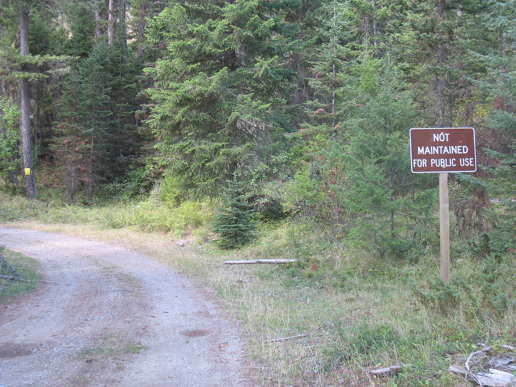
Well, he was right, this road was 17 miles of action, what Ira refers to as adventure cycling. I don't know if you can read the sign in the pic above, but it says "not maintained for public use". The road was pretty hairy at times and I had to ride my brakes for about 10 miles straight of downhill. Now, normally I love the downhill, but on gravel road, it gets pretty easy to loose control of the bike. The road skirted a pretty deep ravine to the left, so caution was the key.
Luckily no bears were spotted on this stretch of the road, however, Ira and I each saw one separately from each other at other sections. Ira was up ahead of me and apparently one lopped after him for about 50 yards freaking the crap out of him. The one I saw crossing the road, stared at me and then started walking toward me, so as I was coming up a hill at that point, I just turned and rode down the hill, waited for a while and then turned and climbed the hill again. He was gone, to my relief. Ira and I were happy to meet back up unscathed from our separate bear encounters.
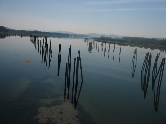
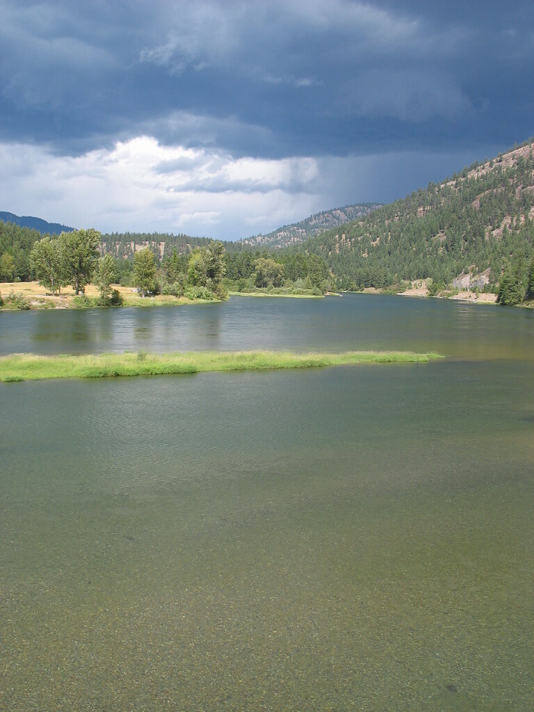
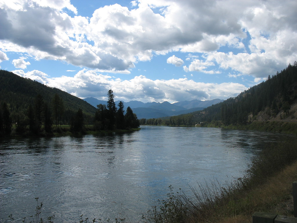
Here are some pics of the Kootenai river which we rode along today. Very pretty.
Well, he was right, this road was 17 miles of action, what Ira refers to as adventure cycling. I don't know if you can read the sign in the pic above, but it says "not maintained for public use". The road was pretty hairy at times and I had to ride my brakes for about 10 miles straight of downhill. Now, normally I love the downhill, but on gravel road, it gets pretty easy to loose control of the bike. The road skirted a pretty deep ravine to the left, so caution was the key.
Luckily no bears were spotted on this stretch of the road, however, Ira and I each saw one separately from each other at other sections. Ira was up ahead of me and apparently one lopped after him for about 50 yards freaking the crap out of him. The one I saw crossing the road, stared at me and then started walking toward me, so as I was coming up a hill at that point, I just turned and rode down the hill, waited for a while and then turned and climbed the hill again. He was gone, to my relief. Ira and I were happy to meet back up unscathed from our separate bear encounters.
Here are some pics of the Kootenai river which we rode along today. Very pretty.
Wednesday, August 30, 2006
Living the wild life in Trego
We've spent the past few days with our friends Jonathan and Deborah, at the studio they are building in Trego, MT. It's a life of luxury for our travel weary butts. They've given us the opportunity to kick back and relax for the first time in two months. We've been going on outings around the area and soaking in the rural Montana culture.
One of the most enjoyable aspects is spending evenings on their back porch.
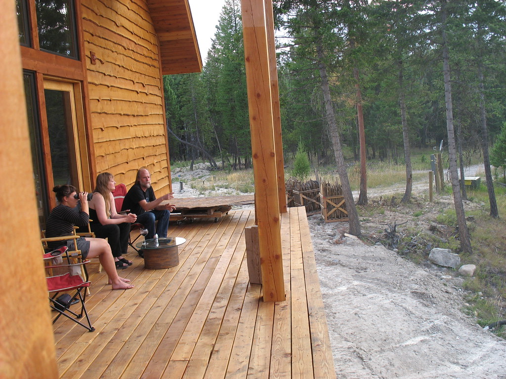
There's no need for a TV when your back yard looks like this.

The porch overlooks a small wetland that seems to be the epicenter for wildlife in the area. We have already seen two black bears and countless deer. It's common for moose to hang out here too. The big animals come here to swim, cool off, and scare the hell out of the ducks.
One of the most enjoyable aspects is spending evenings on their back porch.
There's no need for a TV when your back yard looks like this.
The porch overlooks a small wetland that seems to be the epicenter for wildlife in the area. We have already seen two black bears and countless deer. It's common for moose to hang out here too. The big animals come here to swim, cool off, and scare the hell out of the ducks.
Evian has nothing on this.
Grinnell Glacier is relativly easy to get up close and personal with. Like many people, I had only seen glaciers on the side of drinking water bottles. To see this one, all you have to do is go to the Many Glacier area of Glacier National Park and hike five miles up the side of a mountain.

It was so pretty, and full of huge, jaw-dropping vistas, that I didn't have time to be tired. And then, before i knew it, I was dipping my toe in a glacier.
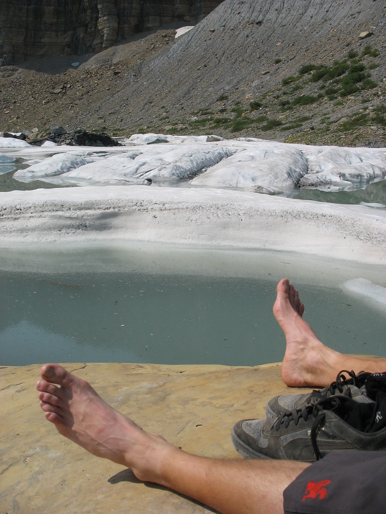
The actual thing is hard to capture in a photo because it covers three hundred acres.
There is a good chance that in thirty years it will be gone.
Here are some links to external pictures, if you want to see the whole thing: Picture 1 Picture 2 (www.philarmitage.net)
It was so pretty, and full of huge, jaw-dropping vistas, that I didn't have time to be tired. And then, before i knew it, I was dipping my toe in a glacier.
The actual thing is hard to capture in a photo because it covers three hundred acres.
There is a good chance that in thirty years it will be gone.
Here are some links to external pictures, if you want to see the whole thing: Picture 1 Picture 2 (www.philarmitage.net)
Tuesday, August 29, 2006
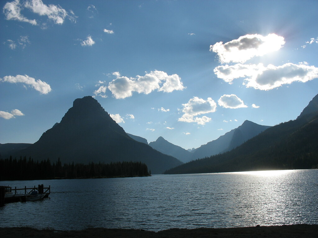
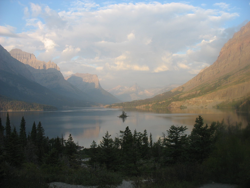
The Crown Of the Continent.
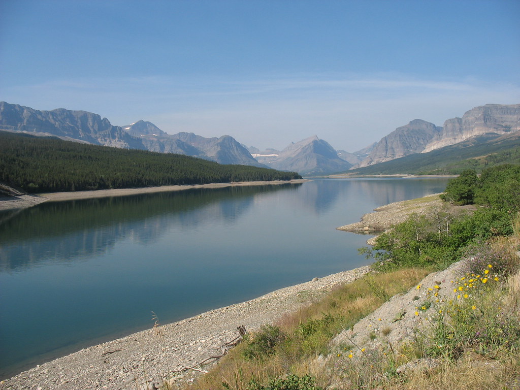
This title Glacier National Park certainly deserves. It consists of over 1.000.000 acres of this country's most beautiful landscape. It captures a pristine mountain paradise in its most raw form. While visiting we saw numerous emerald and turquoise colored glacial lakes, stunning jagged peaks rising into the clouds covered in glacial snow, cascading waterfalls down harsh rocky cliffs, and wildlife as varied as it was numerous. We saw black bears, moose, deer, beavers, big horn sheep, osprey, loons, ducks, as well as various other birds and mammals.
We approached the park from the west, having gone north from Flathead Lake. We decided to circle around the southern border of the park along US2 so we could hit Two Medicine which is located in the south east corner and is not accessible by the going to the Sun Road. Sam, an East Glacier resident let us set up camp in his backyard for two nights so we could visit Two Medicine the next day and save camping fees. While in Two Med, we hiked the Upper and Lower Two Medicine Lakes as well as visited No Name Lake and Twin Falls.
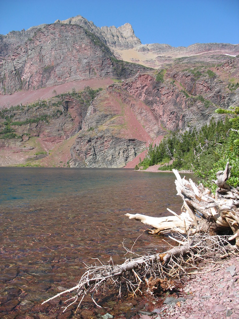
From there we went north up to Many Glacier and stayed there for a day. Here we hiked up the Grinell Glacier and Ptarmigan Tunnel the next day. Each hike was breathtaking. The Grinell trail climed 1600 ft and skirted the side of the mountain. We could look down and view the chain of lakes and see Grinell Lake which had a beautiful turquoise hue.
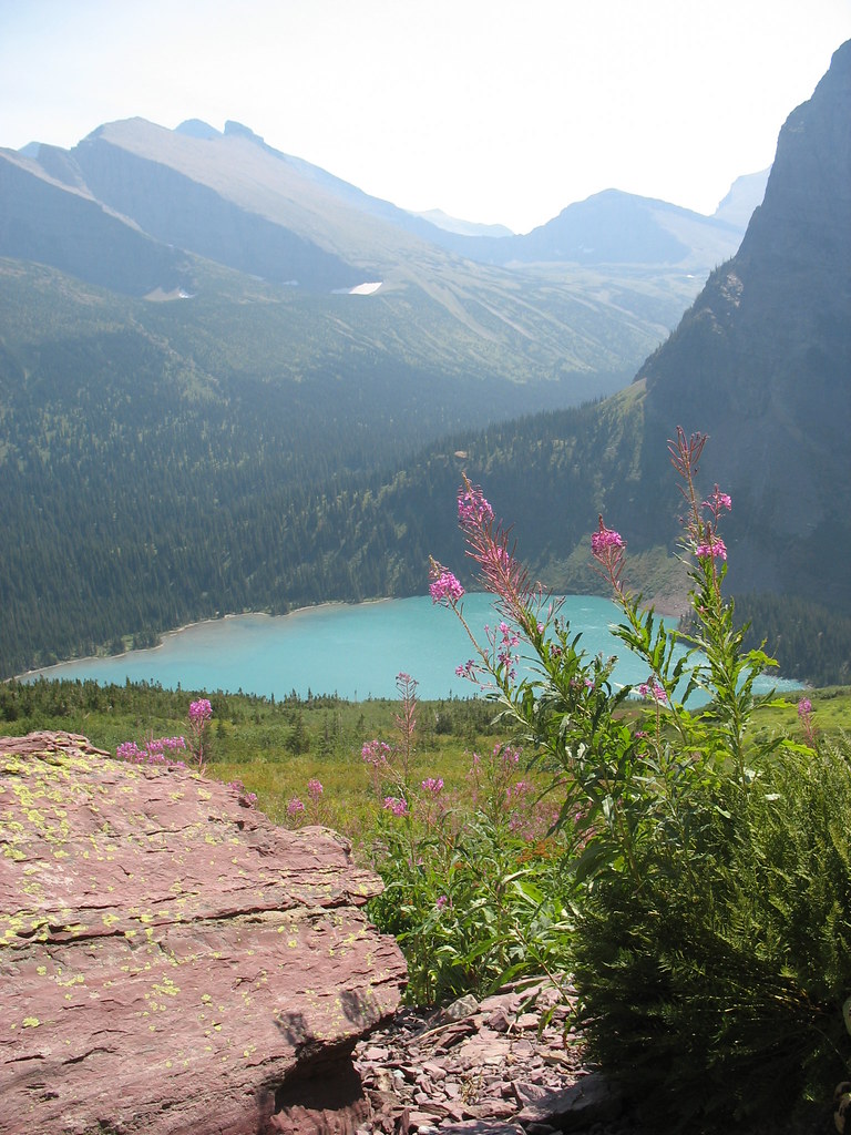
It was an amazing experience to dangle our feet in a Glacier which covers an expanse over 300 acres.

Ptarmigan tunnel trail took us up 2300 ft, and at its top climbs through a 80 ft man made tunnel. Through the tunnel you can view the Belly River Valley, an area which many people belive is the most beautiful are in the park and is only accessible by hiking in.
From Many Glacier we went south backtracking to St. Mary. We were lucky enough to talk Dan Jacobs, the trail crew boss for all of Glacier to let us camp in his backyard for a couple of nights (again to save money). Here we explored the St. Mary Lake and the surrounding waterfalls.
I also did a solo hike (Ira wanted to sleep in) up to Otokomi Lake, another beautiful pristine mountain lake...but cold!!! I jumped in and immediately had to get out. Now I grew up on Lake Superior, and can handle the cold water. However, when you can see the Glacier above which is feeding the lake water, you know its going to be COLD!!
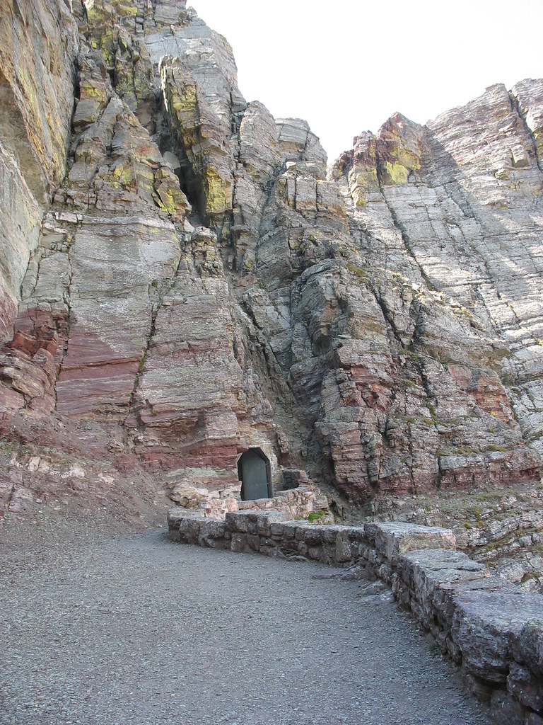
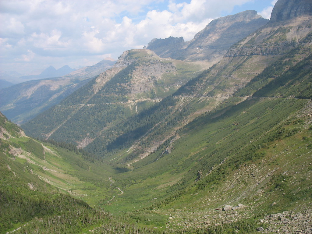
From St. Mary we finally started on our way across the Going-To-The-Sun-Road for our final continental devide crossing at Logan Pass. This road cuts Glacier directly in half. The views from this road are amazing, stunning, incredible. My photos just could not capture it. I can honestly say, this stretch of road was the most beautiful and scenic of the trip and the 12 miles of descent, one of the most amazing of my life.
In the photo above, you can see the road cutting its way down along the mountain side as you view the beautiful valley below.
We rode out to Sprague Creek and camped there for the night. We departed the next day for Trego to stay with friends. Leaving was very bittersweet. There is something in this park which can really grab a hold of a person, almost like an obsession. Ira and I both agree, we are coming back and soon!

It is impossible to describe the scenery, so I haven't really tried. Here is a link to our pics from Glacier, so please just explore these, although once again, not even these photos really capture the majesty.
click here to see the Set of Glacier Pics:
click here to see a Slideshow of Glacier Pics
Friday, August 25, 2006
Montana Steel
As some of you know, we just spent a week in Glacier National Park. There will be a flurry of posting in the next few days because we had a great time and can't wait to talk about it.
On our way into the park, however, we met an interesting guy. His name is Mike and he's lived on a ranch nestled between Glacier and the Flathead State Forest for all of his life. We stopped by his house looking for directions and were invited in.

Mike is standing next to a home-made forge. He uses it to craft some of the most beautiful handmade knives I have ever seen.
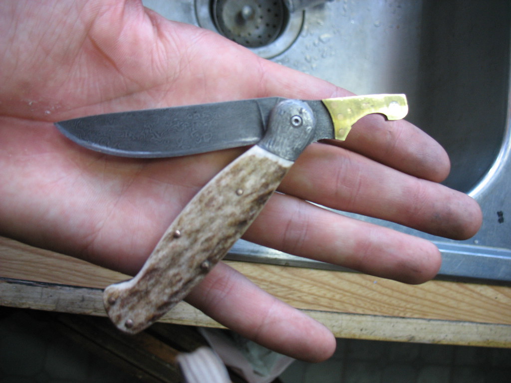
This is one of the main knives that Mike makes. It's an old design that features a button hook on the end, an artifact of the days before zippers. He also makes a version of this knife with a bottle opener. Some of you may notice that the blade is made of damascus steel. Mike forges his own damascus, over five hundreds of layers thick, out of salvaged stock ranging from old saw blades to machine parts.
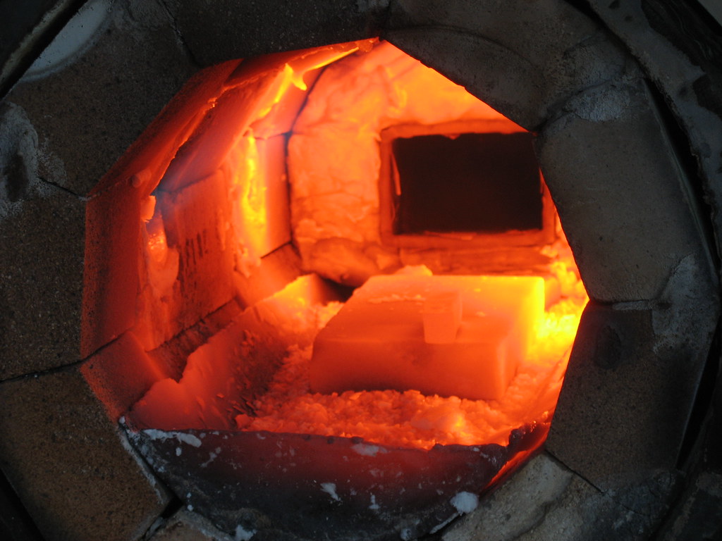
Mike's forge is heated with LP gas and forced air from a compressor. If you look closely you will see a small bar of red-hot metal on top of the center firebrick. It's a rollerbearing from a large machine that will be hammered into a new blade.
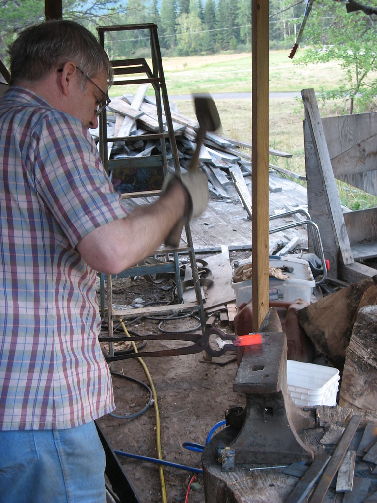
The anvil is an antique that Mike traded his brother for a riding lawn-mower. He says he got the best of the deal. Six of Mike's eight brothers live on the ranch.
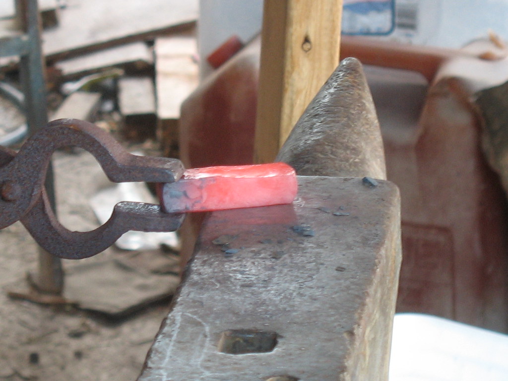
This laborious forging will create a blade of the highest quality. Mike was very humble about his craft, but every knife he showed me was a work of art. We spent over an hour in his kitchen as he explained his process, showing us the pieces of bone and antler that would become knife handles and discussing various knives he had made. When it was time to leave, he gave us directions to a service road that lead into the state forest where we could camp for free.
On our way into the park, however, we met an interesting guy. His name is Mike and he's lived on a ranch nestled between Glacier and the Flathead State Forest for all of his life. We stopped by his house looking for directions and were invited in.
Mike is standing next to a home-made forge. He uses it to craft some of the most beautiful handmade knives I have ever seen.
This is one of the main knives that Mike makes. It's an old design that features a button hook on the end, an artifact of the days before zippers. He also makes a version of this knife with a bottle opener. Some of you may notice that the blade is made of damascus steel. Mike forges his own damascus, over five hundreds of layers thick, out of salvaged stock ranging from old saw blades to machine parts.
Mike's forge is heated with LP gas and forced air from a compressor. If you look closely you will see a small bar of red-hot metal on top of the center firebrick. It's a rollerbearing from a large machine that will be hammered into a new blade.
The anvil is an antique that Mike traded his brother for a riding lawn-mower. He says he got the best of the deal. Six of Mike's eight brothers live on the ranch.
This laborious forging will create a blade of the highest quality. Mike was very humble about his craft, but every knife he showed me was a work of art. We spent over an hour in his kitchen as he explained his process, showing us the pieces of bone and antler that would become knife handles and discussing various knives he had made. When it was time to leave, he gave us directions to a service road that lead into the state forest where we could camp for free.
Thursday, August 17, 2006
Lake effect fun
Water is a big deal out West, and doublely as much for Andrea and I, who are Great Lakes kids. We get super excited whenever there's a lake to jump in, especially if it's big and clean.
Flathead Lake, the largest in Montana, is twenty eight miles of refreshing mountain goodness. It's mostly on the Flathead Indian Reservation, and is clean enough to fish, swim, or do any other lake-orieted activity you can imagine.
We swam and kayaked for two days, and spent all day yesterday cruising along it's shore.
Our new friends Doug and Andrea put us up for two nights and showed us around the area. Doug's the one who took us kayaking. I'll post soon about all of the great people that we've been staying with.
This hill is behind their house- it heads directly to the lake and is made of trecherous gravel. I'm about to attempt some moutainbike action.
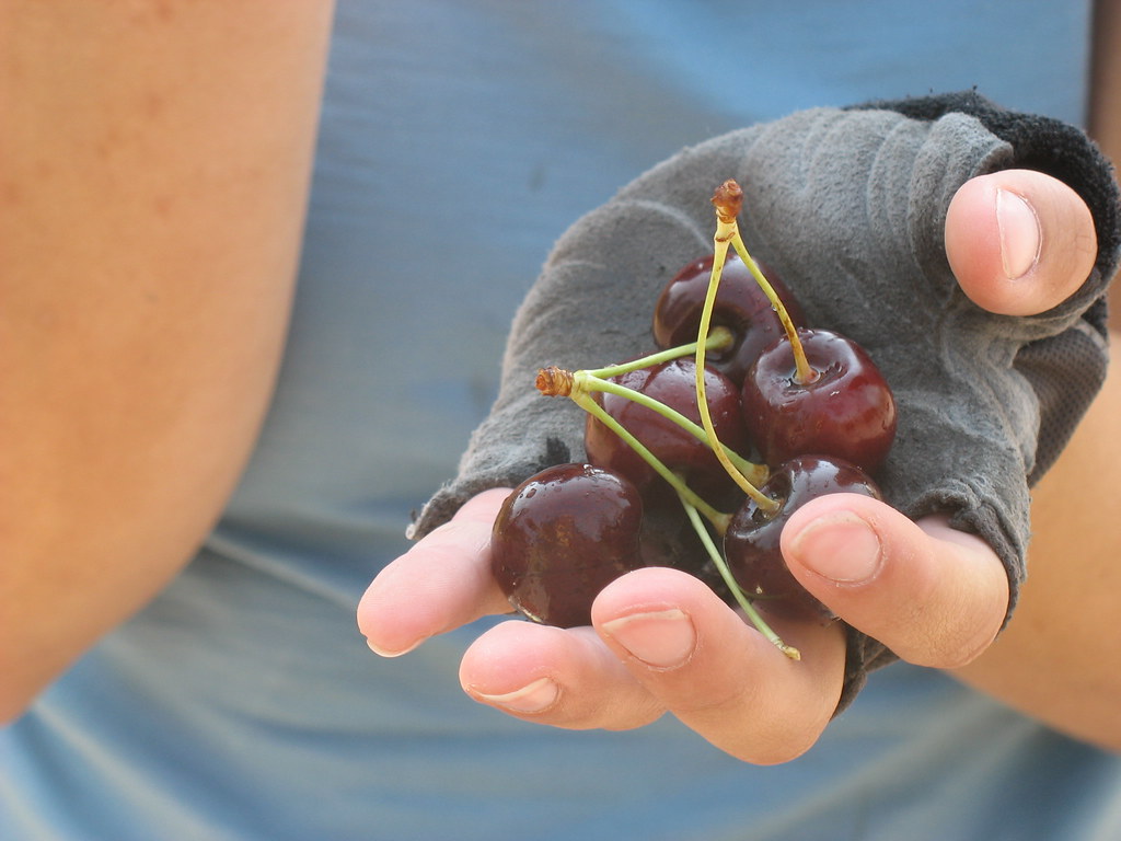
There are cherry orchards all along the east side of the lake. The season is almost over, and you could buy a pound of fruit for a buck. We ate them on the spot and spit pits on the roadside.
Andrea swam here but it was too cold for me! All of the other times we were near the water it felt tropical.
We had some tasty beers on the north shore, from a little brewery across the street from the lake. There was a little patio overlooking the lake, and it felt like being on a boat. Everything was painted bright colors, like we were in Africa or South America.
I keep thinking that it's funny how non-western Montana feels, it's really wild and arty. I guess I was used to the ranchers, cowboys, and sagebrush in Wyoming.
Flathead Lake, the largest in Montana, is twenty eight miles of refreshing mountain goodness. It's mostly on the Flathead Indian Reservation, and is clean enough to fish, swim, or do any other lake-orieted activity you can imagine.
We swam and kayaked for two days, and spent all day yesterday cruising along it's shore.
Our new friends Doug and Andrea put us up for two nights and showed us around the area. Doug's the one who took us kayaking. I'll post soon about all of the great people that we've been staying with.
This hill is behind their house- it heads directly to the lake and is made of trecherous gravel. I'm about to attempt some moutainbike action.
There are cherry orchards all along the east side of the lake. The season is almost over, and you could buy a pound of fruit for a buck. We ate them on the spot and spit pits on the roadside.
Andrea swam here but it was too cold for me! All of the other times we were near the water it felt tropical.
We had some tasty beers on the north shore, from a little brewery across the street from the lake. There was a little patio overlooking the lake, and it felt like being on a boat. Everything was painted bright colors, like we were in Africa or South America.
I keep thinking that it's funny how non-western Montana feels, it's really wild and arty. I guess I was used to the ranchers, cowboys, and sagebrush in Wyoming.
Home is where you hang your hat.
To give you all a better idea of where we stay, I've taken pictues of the places we have stayed for the past week. This week is not completely representational of our trip so far because we only camped out once. We have been incredibly lucky and have scored places to stay every night since last friday night. Usually we are not so lucky. This is this weeks list of our resting spots.
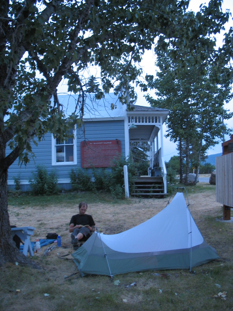
Thursday August 10. Ovando, MT. As you read in the very popular "doggy" post about the people we met touring with their English Cocker Spanials, we happily happened upon a free campsite on the Continental Divide route. We pitched our tent next to the museum in the town square. (The entire town pretty much consists of one street and the town square). The town allows cyclists to camp for free and even supplies a porta-poty.
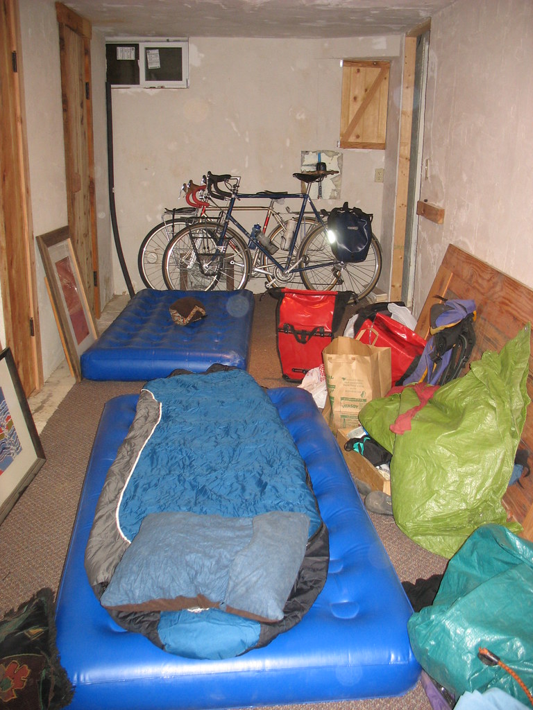
Friday August 11 - Sunday August 13. We camped out in a son of Ira's parents friends house who lives in Missoula. We were each supplied with an air matress and had our own bathroom downstairs with a shower. Very cushy.
Monday August 14 - Tuesday August 15. Colleen who had been so cool to put us up in Helena had given us a name of a friend in Polson on the base of Flathead Lake. We called up Doug and Andrea and they were incredibly hospitable. Not only did they take us in for one night, feed us and give us beer, but they invited us to stay another night! Their house is nestled in the hills at the base of the Mission Mountains, and we spent the next day hiking through the woods near their house and kiyaking on Flathead Lake. Thanks guys!!

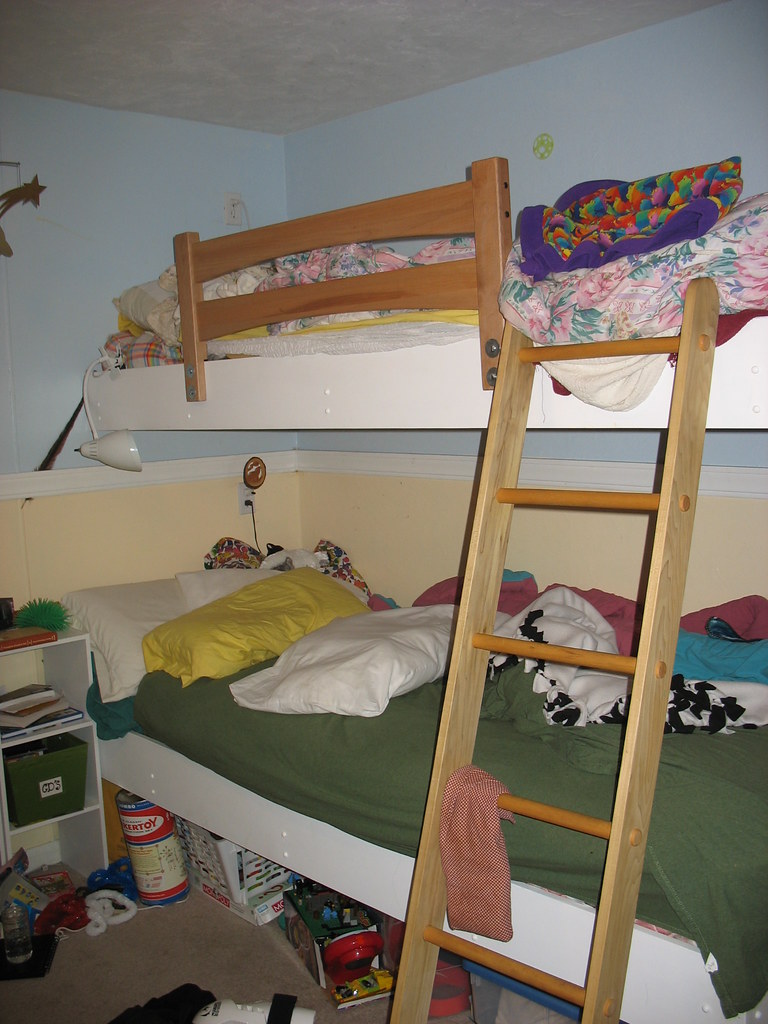
Wed. August 16. Doug and Andrea also hooked us up with a place to stay in Kalispell with their friend Betsy. We pulled in sweaty and stinky and Betsy was ready with dinner, a movie and warm beds. We spent the night in her son's room who was away at his father's house. We woke up this morning to eggs with fresh basil, toast and veggie sausages.
Betsy has given us names of friends to stay with further on down our route. Ira is planning on posting further on the different way in which all the people we stayed with are connected and thier photos so stay tuned.
Thanks sooo much to Colleen and Fam in Helena, Tyler in Missoula, the Doug and Andrea in Polson, Betsy and Fam in Kalispell for all the hospitality, it really means a lot to us!!
We're on to Glacier National Park. I am very excited to visit. You may not hear from us for a week though, so just be warned.
Thursday August 10. Ovando, MT. As you read in the very popular "doggy" post about the people we met touring with their English Cocker Spanials, we happily happened upon a free campsite on the Continental Divide route. We pitched our tent next to the museum in the town square. (The entire town pretty much consists of one street and the town square). The town allows cyclists to camp for free and even supplies a porta-poty.
Friday August 11 - Sunday August 13. We camped out in a son of Ira's parents friends house who lives in Missoula. We were each supplied with an air matress and had our own bathroom downstairs with a shower. Very cushy.
Monday August 14 - Tuesday August 15. Colleen who had been so cool to put us up in Helena had given us a name of a friend in Polson on the base of Flathead Lake. We called up Doug and Andrea and they were incredibly hospitable. Not only did they take us in for one night, feed us and give us beer, but they invited us to stay another night! Their house is nestled in the hills at the base of the Mission Mountains, and we spent the next day hiking through the woods near their house and kiyaking on Flathead Lake. Thanks guys!!
Wed. August 16. Doug and Andrea also hooked us up with a place to stay in Kalispell with their friend Betsy. We pulled in sweaty and stinky and Betsy was ready with dinner, a movie and warm beds. We spent the night in her son's room who was away at his father's house. We woke up this morning to eggs with fresh basil, toast and veggie sausages.
Betsy has given us names of friends to stay with further on down our route. Ira is planning on posting further on the different way in which all the people we stayed with are connected and thier photos so stay tuned.
Thanks sooo much to Colleen and Fam in Helena, Tyler in Missoula, the Doug and Andrea in Polson, Betsy and Fam in Kalispell for all the hospitality, it really means a lot to us!!
We're on to Glacier National Park. I am very excited to visit. You may not hear from us for a week though, so just be warned.
Tuesday, August 15, 2006
What to do in Missoula
The options seem endless. Here are just six.
1) Play bluegrass. It seems like everyone in this town likes country music. We met the Broken Valley Roadshow in Bozeman, and took their invitation to hang out in their home town. It included the high and lonesome sounds of a back-porch session and drinking out of a mason jar.
2) Hunt elk. The guy we stayed with claimed to live off of it. He and a buddy split one last year and there are still eating the meat. They cooked a couple steaks for us.
3) Fly fish. Every store has a fishing section, and you can actually eat out of the rivers.
4) Drink beer. There are three breweries, at least two of which are awesome. We didn't check the third, but locals attest to it's quality.
Kettle House is a straight-up microbrewery. It's the kind of place that makes you want to hang out all day. The have a couple of nitrogen-charged beers(think Guiness or Bodingtons).

Bayern makes authentic German-style lagers. They also have cats all over the place, and make Trout Slayer, the best bottled beer around here.
5) Go mountain biking. We rode in the Rattlesnake Rec Area on borrowed bikes. It was some of the best off-road riding I've ever done.
6) Go on a bike tour. Adventure Cycling, authors of the most comrehensive maps ever, are located here. The gave us free ice cream and took our picture.
1) Play bluegrass. It seems like everyone in this town likes country music. We met the Broken Valley Roadshow in Bozeman, and took their invitation to hang out in their home town. It included the high and lonesome sounds of a back-porch session and drinking out of a mason jar.
2) Hunt elk. The guy we stayed with claimed to live off of it. He and a buddy split one last year and there are still eating the meat. They cooked a couple steaks for us.
3) Fly fish. Every store has a fishing section, and you can actually eat out of the rivers.
4) Drink beer. There are three breweries, at least two of which are awesome. We didn't check the third, but locals attest to it's quality.
Kettle House is a straight-up microbrewery. It's the kind of place that makes you want to hang out all day. The have a couple of nitrogen-charged beers(think Guiness or Bodingtons).
Bayern makes authentic German-style lagers. They also have cats all over the place, and make Trout Slayer, the best bottled beer around here.
5) Go mountain biking. We rode in the Rattlesnake Rec Area on borrowed bikes. It was some of the best off-road riding I've ever done.
6) Go on a bike tour. Adventure Cycling, authors of the most comrehensive maps ever, are located here. The gave us free ice cream and took our picture.
Saturday, August 12, 2006
Big Sky Coutnry For Real
Riding from Boseman to Helena to Missoula, Montana has been characterized by wide flat river valleys surrounded by mountains. This is the real Big Sky Country.
Riding into the storm, around Boseman
Highway 12 into Helena
Highway 200, into Missoula
Sunset at our hay bale campsite
Highway 200 riding into Missoula
Riding into the storm, around Boseman
Highway 12 into Helena
Highway 200, into Missoula
Sunset at our hay bale campsite
Highway 200 riding into Missoula
We climb mountains and love dogs.
We crossed the Continental Divide at MacDonald Pass. Not to sound like a total wimp, but we had a headwind the entire time and it was really hard.

We triumphed, however. As you can see, this was not our highest pass.
We camped in the national forest at the top of the hill. It was beautiful, and at night a weird phenomenon occured: there was a faint blinking light shining against one side of out tent. It flashed on every four seconds, for a durration of a second. When veiwed from the outside, it appeared to be coming from within the tent! We investigated the light very thoroughly and were unable to figure out anything more about it's origin. SPOOKY!

Andrea is drinking from an artesian well on the side of the mountain. There were two vans full of people from Helena who were filling jugs and tanks of water.
"It's the only water I drink," said one woman, "The city water is full of chemicals to kill algea and things."
This couple, from Gaylord, MI, is riding the Continental Divide with their dogs. The dog run up the hills and ride down in the trailers.
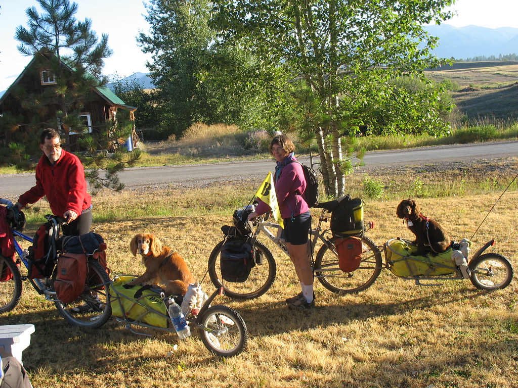
We ran into them in Ovando, MT, which is a camping area designated by Adventure Cyling. The trail they are riding is all off-road, and the have to be cautious about bears that try to eat their dogs.

I think that having a dog that will go moutain biking with you is just about the greatest thing.
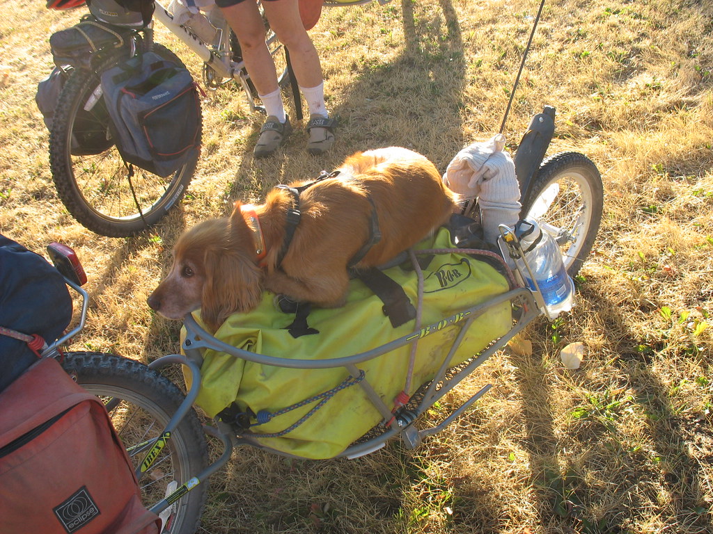
How could a bear eat something this cute?
We are in Missoula right now, and having a great time.
We triumphed, however. As you can see, this was not our highest pass.
We camped in the national forest at the top of the hill. It was beautiful, and at night a weird phenomenon occured: there was a faint blinking light shining against one side of out tent. It flashed on every four seconds, for a durration of a second. When veiwed from the outside, it appeared to be coming from within the tent! We investigated the light very thoroughly and were unable to figure out anything more about it's origin. SPOOKY!
Andrea is drinking from an artesian well on the side of the mountain. There were two vans full of people from Helena who were filling jugs and tanks of water.
"It's the only water I drink," said one woman, "The city water is full of chemicals to kill algea and things."
This couple, from Gaylord, MI, is riding the Continental Divide with their dogs. The dog run up the hills and ride down in the trailers.
We ran into them in Ovando, MT, which is a camping area designated by Adventure Cyling. The trail they are riding is all off-road, and the have to be cautious about bears that try to eat their dogs.
I think that having a dog that will go moutain biking with you is just about the greatest thing.
How could a bear eat something this cute?
We are in Missoula right now, and having a great time.
FAQ
Here in Montana, the public libraries seem to limit computer usage to 30 minutes, so I don't have a long time to upload photos and do a typical log. I figured this would be a good time to do a quick post of FAQ.
Everywhere we go, people keep asking us the same questions. I figured people out here in the world wide web may be wondering the same things. I may be repeating myself for people who have been following us since the beginning, but for all who have just tuned in recently and don't feel like reading all the way back to the beginning, these are the answers to the basic questions.
1. Where are you from.
This is a more difficult question to answer then it looks because it brings up many more questions, like what do you consider your true home. Ira and I started our trip in Chicago. We have both lived in Chicago for many years (me:8 Ira:6). However, Ira usually tells people he is from northern Wisconsin and I say I am from U.P. (although my family doesn't live there anymore) But to be brief, we say we started out in Chicago.
2. Where are you headed.
Well currently we are in Missoula, MT. We are headed back north east to Glacier Ntl. Park and then to whitefish MT, through Idaho, Washington to Vancouver BC and then south to San Francisco. We plan on taking Nov., Dec., and Jan off to be in the Midwest, spend the holidays with our families and get holiday jobs to add to our trip fund. Then in late Jan, we think we are going to start in Austin TX and work our way around the gulf, through Georgia, and up the east coast. This leg of the trip isn't really planned solidly yet, but that is the gist.
3. How do you plan your routes?
We have been planning things more day to day then long term route plans. We generally use the free state maps and plan around those. However, we have been asking locals in bike shops or cool people we've gotten into conversations with on the streets, what the best places in the area to go through. We also ask for road conditions and elevation changes. By doing it this way, we have been able to see a lot of things which we never would have known about, like the Bear Lodge Mountains in eastern Wyoming, and the shortcut on Trail Creek Road to Boseman.
4. What kinds of roads do you ride on?
We ride on mostly state highways and some US highways. When we were back in the Midwest, we rode on a lot more county roads, but out west the county roads are few and far in between and are generally unpaved. We have had to ride on the interstate 3 times. Yes, I know it is illegal to ride on the interstate in IL and MI, but out here where roads are few, we have hit patches where the road we are on dead ends at the interstate and it is the only option forward. The longest we had to ride it ever, was 20 miles in South Dakota, outside of Wall. Riding on the Interstate is not a lot of fun, but not totally scary either. They have incredibly wide shoulders, so if we hug the outside edge we basically have an entire lane between us and the zooming cars. However, we always try and stay on the roads with less traffic. Traffic was little to non existent even on the bigger highways in South Dakota and Wyoming, where everyone travels through on the interstate. Here in Montana, the traffic is a little heavier, but still nothing that bad. We always tell locals when they comment on bad traffic here, we are from Chicago, and nothing can be worse then that!
5. Are you guys rich?
This question is usually posed to us by bikers, by which I mean motorcylists. They seem to have less inhibition on just coming out and asking that. Others ask what kind of jobs we have to allow us this time off. The answer is, no unfortunately, Ira and I are both far from rich. We spent the last year of our lives, working overtime, eating beans and rice and hardly ever going out, to be able to buy a year of our life off. I worked for a large Custom Frame shop and Ira worked as an IT tech for a computer company. We quit our jobs and are now riding our bikes every day for our job.
6. Where do you sleep?
We camp or stay with friends and acquaintances. We have stayed twice in a motel. We generally try and plan our routes around where we have people to stay with. Otherwise, we will camp. Early on in the trip we were trying to find typical campgrounds all the time, but that got a little expensive, and we really didn't get to meet as many locals. We decided once we got into Montana, we were going to try and go the entire state without paying for a campsite (except in Glacier). We have been trying hard to find people to stay with through friends or the internet, and when we don't have any planned place to stay, we will just pick a spot on the map to ride to and then find a place when we get there. Usually by asking people if we can set up on their lawn or in their fields.
Well, I am running out of time. I know there are more questions to be answered and I only half answered these. If any of you guys have more questions, please make comments to us. We love when people comment, because it makes it more of an interactive experience for us and less like we are just yammering out in space.
Till next time...
Wednesday, August 09, 2006
Montana!!!
Hello. No time for pics etc, the Helena public library only gives us 30 min of use. So to be brief. We've been in Montana a little less then a week and I can tell you right now, I really like Montana. We stayed with a Ira's friend, Randy in Boseman which was very fun, and we stayed with an awesome family last night in Helena. We met Colleen and Logan (her five year old son) outside the library yesturday and after hearing of our adventure immediatly invited us home with her for dinner, a warm shower and inside sleeping accomodations!! How wonderful.
We are funning a week ahead of schedule (i of course meant to write running, but then i reread it and kind of liked funning, so i'm leaving it) so we have decided to mozy up to Missoula and then back track east to Glacier Ntl. Park.
More from Montana later, with more pictures of course.
We are funning a week ahead of schedule (i of course meant to write running, but then i reread it and kind of liked funning, so i'm leaving it) so we have decided to mozy up to Missoula and then back track east to Glacier Ntl. Park.
More from Montana later, with more pictures of course.
Tuesday, August 08, 2006
En route from Bozeman to Helena we spent the night between two collosal piles of hay. The bales were four feet tall and the piles themselves over two stories. There was an alley between them wide enough for our tent and all our gear. It felt like being in the ruins of some giant temple built by grasshoppers.

I usually like to ask permission before camping somewhere, but it's wasn't posted and it's hard to know who owns what when the houses are over two miles appart.
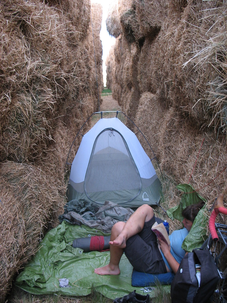
It was quite cozy, surrounded by sweet smelling hay. After dark, I climbed on top of one pile and layed there, checking out the sky. You could see the lights of ranches in the distance, and the only sound was the far of whir of trucks on the highway and the dragonflys zipping around eating insects.
I usually like to ask permission before camping somewhere, but it's wasn't posted and it's hard to know who owns what when the houses are over two miles appart.
It was quite cozy, surrounded by sweet smelling hay. After dark, I climbed on top of one pile and layed there, checking out the sky. You could see the lights of ranches in the distance, and the only sound was the far of whir of trucks on the highway and the dragonflys zipping around eating insects.
Subscribe to:
Posts (Atom)